

 Español
Lanzarote cycling Tour is an unmissable event for cycling enthusiasts looking for a unique long-distance experience on the island. The 2024 edition, held on September 28 and 29, attracted amateur and experienced cyclists from different parts of the world. The event, backed by Club La Santa, the Cabildo of Lanzarote, and the Canary and Spanish Cycling Federations, is non-competitive, allowing participants to focus on enjoying the scenery and the challenge without the pressure of competition. With a total of 189 kilometers over two stages, the Vuelta spans all of Lanzarote’s municipalities, showcasing the diverse landscapes that characterize this volcanic island.
For those who couldn’t join the adventure in 2024, a new opportunity awaits in October 2025. Here, we go over the details of the Vuelta route, highlighting each section with its ascents, descents, and varied terrain. At the end, we include registration information for the upcoming edition of the Vuelta a Lanzarote, which is expected to surpass the success of this year.
Stage 1: From Tinajo to Haría – Exploring Western Lanzarote
The first stage begins in the municipality of Tinajo, located in the volcanic heart of the island, known for its stunning lava landscapes and rocky formations. From here, cyclists set off toward La Santa, where the sea breeze and festive atmosphere combine with the physical demands of the route. This starting point marks the beginning of a day full of ups and downs, both in altitude and excitement, leading participants through some of Lanzarote’s most challenging terrain.
The stage advances toward Famara, a small coastal village famous for its waves and bohemian vibe. The coastal stretch allows cyclists to enjoy a brief respite, with flat terrain inviting them to pick up speed. From here, the route continues inland, heading towards Teguise, the former capital of Lanzarote. This charming town, rich in history and cobblestone streets, signals the start of a gradual ascent, where the challenge intensifies as cyclists move north.
Technical Data for Stage 1, Lanzarote Cycling Tour
- Average Speed: Cyclists’ average speeds in this first stage range from 20 to 29 km/h, with variations depending on the terrain.
- Total Ascent: The mountainous terrain of this stage includes climbs of up to 226 meters in certain sections, especially in the northern area heading towards Haría.
- Total Descent: Accumulated descents reach up to 337 meters, allowing cyclists to gain momentum on the downhill stretches.
Upon reaching Haría, a picturesque village in the north of the island surrounded by palm trees, cyclists encounter one of the highest points on the route in terms of altitude. Here, participants are welcomed by enthusiastic spectators and supported by refreshment points that turn into authentic “fan zones” to cheer on the athletes. This first day of the route ends in Haría, giving cyclists a chance to rest before the next stage.
Download GPX Stage 1
Stage 2: Discovering Eastern and Central Lanzarote
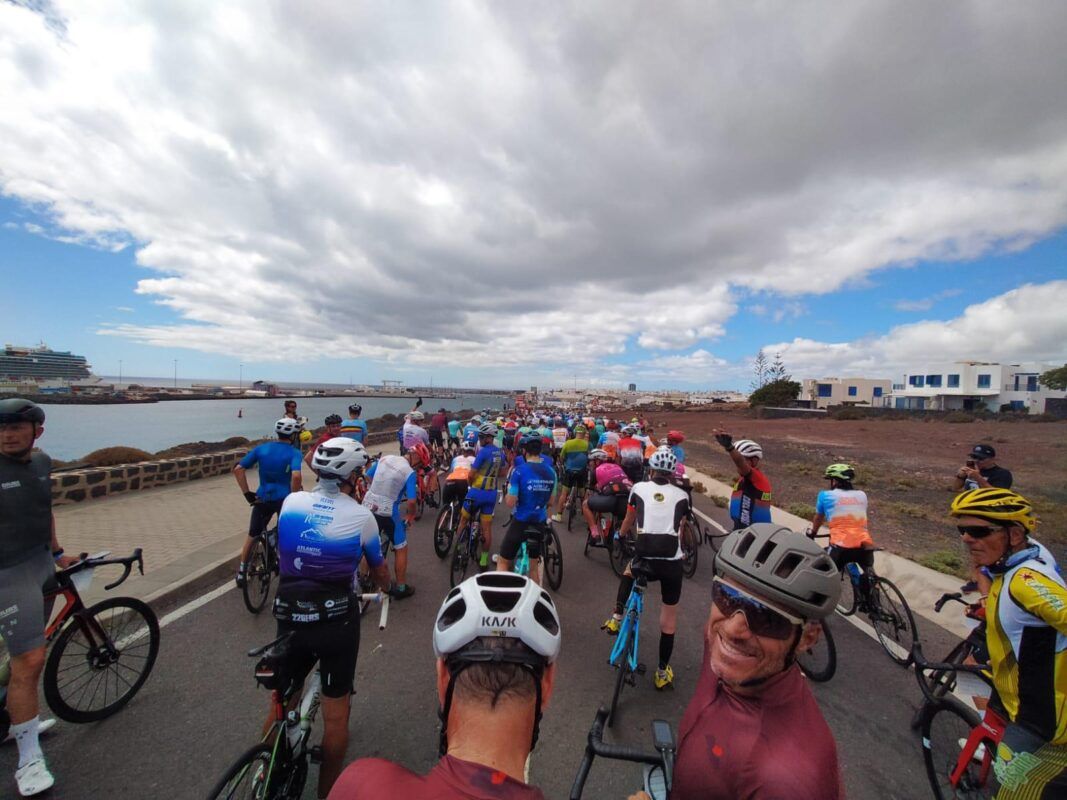
The second stage focuses on the eastern part and the center of the island, passing through municipalities such as Arrecife, San Bartolomé, and Tías, and finishing in the south at Yaiza. With predominantly paved terrain, this stage allows cyclists to maintain higher speeds, resulting in a higher average speed compared to the first day. However, the challenge persists at every kilometer, especially as the route traverses hills and steep descents.
The day begins in Arrecife, the capital of Lanzarote, where the urban setting and proximity to the sea create a unique backdrop for the first few kilometers. After leaving the capital behind, the route heads to San Bartolomé, known for its vineyards and the green landscape that contrasts with the rest of the island. Here, cyclists face a gentle but steady climb, preparing them for the faster stretches that lie ahead.
After San Bartolomé, the route continues towards Tías, a municipality with spectacular ocean views and terrain that alternates between hills and plains. The combination of asphalt and more technical surfaces in this section allows cyclists to showcase their skills and enjoy some of Lanzarote’s most expansive landscapes.
The final stretch heads south to the municipality of Yaiza. This area, known for its volcanic landscapes and proximity to the Timanfaya National Park, allows cyclists to experience the majesty of the volcanic terrain as they approach the finish line.
Technical Data for Stage 2 Lanzarote Cycling Tour
Para más información sobre el evento y la inscripción, visita Club La Santa.